Misamis Occidental (Province of Misamis Occidental)
 |
The province is named after the early settlement of the Spaniards at the entrance to the Panguil Bay. The name Misamis is believed to have been derived from the Subanen word kuyamis which is a variety of coconut, the staple food of the early settlers. During the years the name persisted as an inference of the geographical location, and upon the advent of the Spanish settlers, the word kuyamis easily gave way to the more convenient pronounceable but corrupted word Misamis.
The area of now Misamis Occidental was first occupied by Subanen and later Visayans settled in the coastal areas. The name Misamis is derived from Subanen word kuyamis which is a variety of coconut. During the 1750s was the time that the coastal villages in southern Luzon, Visayas and Mindanao suffered attacks from bands of Muslim pirates, who burned houses and crops, and captured people to be sold as slaves in Maguindanao, Sulu, Borneo or the islands now known as Indonesia. In response, the colonial government in Manila created a flotilla and appointed a Spanish Jesuit missionary, José Ducos, as its commander.
After several successful battles against the pirates, when some peace had been restored, it was decided to build a stone fort at the mouth of Panguil Bay, at a place called Misamis, and Ducos was put in charge of the construction. The construction began in 1756. It was officially called “Fuerte de la Concepción y del Triunfo”.
* 1818 — Mindanao was organized into five politico-military districts, one of which was the Segundo Distrito de Misamis, the largest district in Mindanao. This area was composed of today's Misamis Oriental, Misamis Occidental, Camiguin, Bukidnon, Lanao, Zamboanga del Norte, and the northern part of Cotabato.
* 1850 — the town of Misamis became the capital of the district of Misamis until February 27, 1872, when the Spanish Governor General Carlos María de la Torre y Navacerrada issued a decree declaring Cagayan the permanent capital of Segundo Distrito de Misamis. During this era, the name of the town was Cagayan de Misamis.
* November 2, 1929 — Legislative Act No. 3537 passed, dividing the old province of Misamis into Misamis Occidental and Misamis Oriental, which took effect on January 1, 1930. Misamis Occidental comprised the original nine towns of Baliangao, Lopez Jaena, Tudela, Clarin, Plaridel, Oroquieta, Aloran, Jimenez, and Misamis. Don José Ozámiz y Fortich became the first governor.
* January 6, 1930 — the provincial council of Misamis Occidental selected Oroquieta to become the capital town (cabecera) of the province.
* 1935 — the Provincial Capitol Building, commonly called Capitolio, begun and became the seat of executive and legislative power of the province, in the town of Oroquieta.
* May 6, 1942, the Japanese Imperial forces landed in Misamis Occidental, beginning their brief occupation of the province during World War II. In 1945, combined American and Philippine Commonwealth forces liberated the province, and with the help of the recognized guerilla units, defeated the Japanese forces. During World War II, Misamis became the capital of the Free Philippines as the seat of government of the Free Philippines then was the Capitolio. The United States Forces in the Philippines under Colonel Wendell Fertig based in Misamis Occidental, was the rallying point for the guerrillas in Mindanao. This was historically significant because it is the only time in Philippine history when its capital was in Mindanao, in the region then known as Misamis. The Free Philippine Government was then issuing Misamis Occidental emergency notes. Late President Manuel L. Quezon, upon knowing that Oroquieta was made a capital of the Free Philippines and that the town was issuing emergency notes, authorized the printing of the Mindanao emergency note.
Map - Misamis Occidental (Province of Misamis Occidental)
Map
Country - Philippines
 |
 |
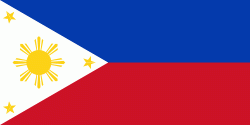
| Flag of the Philippines | |
Negritos, some of the archipelago's earliest inhabitants, were followed by successive waves of Austronesian peoples. Adoption of animism, Hinduism and Islam established island-kingdoms called Kedatuan, Rajahnates, and Sultanates. The arrival of Ferdinand Magellan, a Portuguese explorer leading a fleet for Spain, marked the beginning of Spanish colonization. In 1543, Spanish explorer Ruy López de Villalobos named the archipelago Las Islas Filipinas in honor of Philip II of Spain. Spanish settlement through Mexico, beginning in 1565, led to the Philippines becoming ruled by the Spanish Empire for more than 300 years. During this time, Catholicism became the dominant religion, and Manila became the western hub of trans-Pacific trade. In 1896, the Philippine Revolution began, which then became entwined with the 1898 Spanish–American War. Spain ceded the territory to the United States, while Filipino revolutionaries declared the First Philippine Republic. The ensuing Philippine–American War ended with the United States establishing control over the territory, which they maintained until the Japanese invasion of the islands during World War II. Following liberation, the Philippines became independent in 1946. Since then, the unitary sovereign state has often had a tumultuous experience with democracy, which included the overthrow of a decades-long dictatorship by a nonviolent revolution.
Currency / Language
| ISO | Currency | Symbol | Significant figures |
|---|---|---|---|
| PHP | Philippine peso | ₱ | 2 |
| ISO | Language |
|---|---|
| EN | English language |
| TL | Tagalog language |


